Coordinate systems in GeoSpatial Data Processing
The Foundation of Web Mapping
When working with geospatial data for web applications or GIS, understanding coordinate reference systems (CRS) is non-negotiable. The two most common and critical formats you will encounter are EPSG:4326 and EPSG:3857.
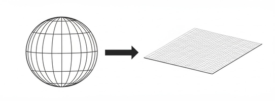
EPSG:4326 (WGS 84)
This is the standard used by GPS devices and Google Earth. It represents the earth as a 3D ellipsoid and uses Latitude and Longitude degrees. GeoJSON files strictly require coordinates to be in EPSG:4326.
EPSG:3857 (Web Mercator)
This is a 2D projected coordinate system used for rendering maps on flat screens. Services like Google Maps, OpenStreetMap, and Mapbox use this projection. Coordinates are in meters (X and Y).
Data Processing Pipeline
A standard spatial pipeline often involves storing or transmitting data in EPSG:4326 (lat/lon), but projecting it to EPSG:3857 on the fly when rendering map tiles or doing 2D distance calculations!